In September 2026, the UN General Assembly adopted the "Correct the Map" resolution, encouraging governments, schools, and tech companies to switch to the Equal Earth projection.
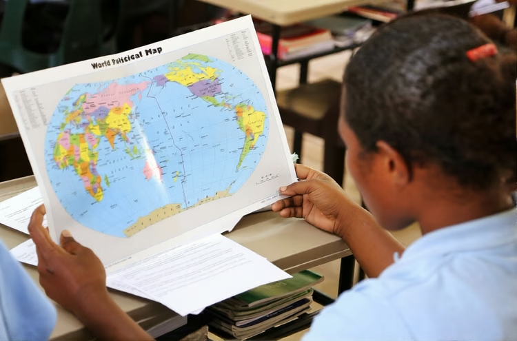
If you grew up looking at a world map in any classroom, you probably saw Africa sitting somewhere in the middle, looking roughly the same size as Greenland. That map was wrong, and it has been wrong for over four centuries. The continent you call home is about 14 times larger than Greenland, but on the Mercator projection that has dominated classrooms, textbooks, and digital platforms for generations, Africa appears shrunken and marginalised. In September 2026, the United Nations General Assembly took a historic step to correct this, adopting the "Correct the Map" resolution with overwhelming support.
The Map That Made Africa Look Small
The Mercator projection was devised in 1569 by Gerardus Mercator, a Flemish cartographer who needed a map that would help sailors plot straight-line courses across the oceans. His projection preserved angles and directions, which made it invaluable for navigation. But preserving direction came at a high cost: landmasses far from the equator, like Europe, North America, and Greenland, were exaggerated in size, while equatorial regions, including Africa and South America, were compressed. The result is a map where Greenland looks comparable to Africa, when the reality is that the African continent is fourteen times larger. For centuries, this distortion quietly shaped how generations perceived the continent's weight and its place in the world, influencing education, media, and even policy.
What the UN Resolution Actually Changes
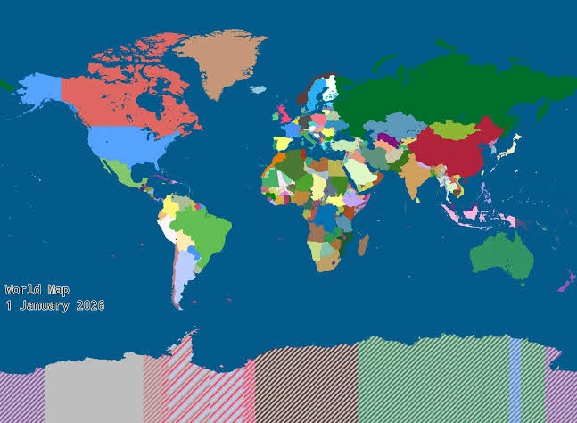
The "Correct the Map" resolution, proposed by Togo and endorsed by the African Union before winning support at the UN, does not ban the Mercator projection, which remains fully suited for maritime and aerial navigation. Instead, it encourages governments, schools, international organisations, and technology companies to use the Equal Earth projection, a 2018 equal-area map that more accurately represents the relative sizes of continents without distorting their proportions. The resolution is non-binding, but its symbolic weight is enormous. Zambia's Permanent Representative to the United Nations, Dr Chola Milambo, described the adoption as a historic moment for Africa and other marginalised regions, noting that "for centuries, the map was not depicted correctly". The vote was 164 to 1, with the United States casting the sole opposing vote and six countries abstaining.
Why This Matters for Zambia and Africa
Maps are never just decorations. They shape how people see the world and the balance of power within it. When generations grow up seeing Africa drawn far smaller than it really is, that visual impression can quietly influence perceptions of the continent's economic and geopolitical significance. The resolution describes correcting these distortions as an act of "cognitive justice and memorial reparation," acknowledging that the symbolic minimisation of Africa has had real consequences.
The Equal Earth Projection and What Comes Next
The Equal Earth projection, developed in 2018, was designed to address the specific problem of area distortion while keeping maps readable and visually familiar. It does not make Africa larger than it is; it simply removes the exaggeration that Mercator gave to landmasses closer to the poles. Over the next six months, Togo plans to consult African Union member states and supporters in other regions to promote wider adoption, with education identified as a key arena for change. France has already announced plans to abandon the Mercator projection in favour of more accurate representations, and advocacy organisations are pushing for accurate maps in schools, newsrooms, and digital platforms. The real work, as one campaigner put it, is only beginning.
The Bottom Line
Africa is not changing size. What is changing is the willingness of the world to see the continent as it truly is, in its true dimensions and in its rightful place. For Zambians, this resolution is a reminder that the way we represent the world matters, and that correcting a centuries-old distortion is not just about geography, but about how we value the places we come from. The next time you look at a world map, take a moment to notice how Africa is drawn. If it looks small, you are probably looking at a Mercator. If it looks right, you are looking at the future.